





Fresh snowfall, rains lash Kashmir; wet spell likely to continue till October 15
STC NEWS DESK
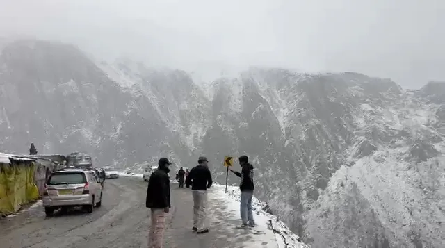
SRINAGAR, OCTOBER 13 (STC): Owing to an active Western Disturbance, higher reaches of Kashmir received fresh snowfall while rain continued across the plains, including Srinagar, today.
The Meteorological Centre Srinagar has predicted unsettled weather over Jammu and Kashmir for the next two days, with the possibility of rainfall, snowfall and thunderstorms at several places.
Light to moderate snowfall was recorded in the higher reaches, including the popular tourist destinations of Gulmarg and Sonamarg, as well as along the Zojila axis.
Meanwhile fresh snowfall has been reported from the Tulail region of Gurez Valley and Razdan Pass in north Kashmir’s Bandipora district.
Travellers have been advised to exercise caution and check the latest road conditions before starting their journey.
Rainfall was reported from the plains, bringing a spell of wet weather to the Valley.
Light to moderate rain is likely at many places, while higher reaches may receive light snowfall between October 13 and 15. Thunderstorms and hailstorms are also possible at isolated locations during this period, says weatherman.
The weather is expected to improve from October 16, although a brief spell of light rain cannot be ruled out at isolated places. Generally dry conditions are likely to prevail from October 17 to October 24, according to the forecast.
People have been urged to follow official traffic advisories and take precautions during thunderstorms and gusty winds.
(Straight Talk Communications)